
 In the aftermath of the destruction and tragedy that has been left in Oklahoma this past week, I’d like to use this forum to bring something good into all of this: education. For this week’s weekly weather wisdom, let’s take some time to talk about Tornado Safety.
To those of you who think “I’ll never see a Tornado in my life”, “it’ll never happen to me”, or “we don’t get that kind of weather here”, I have another saying I’d like to share with you: “You never know”. Everyone, and I mean everyone, should take a few minutes to educate themselves about tornado safety.
It’s understandable for people to panic when something like a tornado comes roaring their way; it’s a deadly storm that has the capability of leveling houses, tossing cars through the air, destroying schools, and killing hundreds of people. Overall, tornadoes are very scary things to face. However, a little know-how before facing a twister could save the lives of you, your family, and your friends.
Where?
Let’s start by quickly talking about where you might encounter a tornado. First off, tornadoes have been seen in every state in the US (including Alaska and Hawaii). While this holds true, let’s pin-point where you’re most likely at risk. As shown in the graphic below, the areas with the most tornado activity are in the Mid-West and Great Plains, with moderate risk along the entire Eastern sea-board as well. Again, tornadoes have no boundaries, so be mentally prepared to see one some day.

When?
First of all, tornadoes can occur at any time of day, and are common in the afternoons, evenings, and at night. While tornadoes have occurred in every month of the year, “Tornado season” starts to kick up around April, with the peak of the season occurring during early summer and last through August. Additionally, tornadoes are commonly associated with two specific weather events. Twisters are most commonly seen during Severe Thunderstorm events, as instability of the atmosphere makes a perfect breeding ground for twisters. Hurricanes have also been known to produce tornado outbreaks, most notably the 53 confirmed tornadoes that spawned along the outer bands of Hurricane Katrina as it made landfall.
What to do
Let’s move on to what to do if you are aware of a tornado possibly headed in your direction… Curiosity may have killed the cat, but when it comes to the weather I’m constantly peeking outside to see what’s happening; it’s human nature to want to look outside during any kind of unusual weather event. Regardless, once you’ve assessed the threat it’s time to take action:
If you’re at home, get to a basement or bottom floor, and head to a small centrally located room. Padding such as blankets, mattresses, sleeping bags can provide some protection if things fall on top of you. If you’re at work, retail location, church, etc. the same principles apply. Do not use elevators to access lower floors, and avoid windows as much as possible.
If you are outdoors try to locate a nearby shelter. If none is nearby, find a low-lying ditch and get as low to the ground as possible. Stay far away from trees, power lines, and other objects that may be blown toward you.
If you are in a car, only attempt to out-drive a twister if it is far away and you have a clear route in the opposite direction. If not, leave your vehicle and head for shelter. If none exists, follow tips above for outdoor tornado strategies.
Before a Tornado
The Boy Scouts got it right… Be Prepared! Practicing a tornado drill with your family is never a bad idea; make sure everyone is informed and ready in case of such emergency. As for supplies I like to keep a gallon or two of water as well as some granola bars stashed in a bin down in the basement in case of such emergencies. Flashlights, radios, walkie talkies, and sterile rags/bandages are also a smart addition to such a kit.

For more information about Tornado Safety, consult the following resources:
 For those of you whom are particularly enjoying Spring, consider yourselves lucky, as this one was tame by DC standards. Average high temperatures for the month of April are typically in the mid to upper 60s, while May showcases highs between 70 and 80 degrees. So far this Spring, we’ve seen 27 days in the 60s and just 10 days creep up above 80°F. We’ve also seen about half as much rain as we normally do here in the DC Metro area. Overall, it’s been a prolonged cool dry season, differing from many past DC Springs that felt more like a leap straight from Winter to Summer.

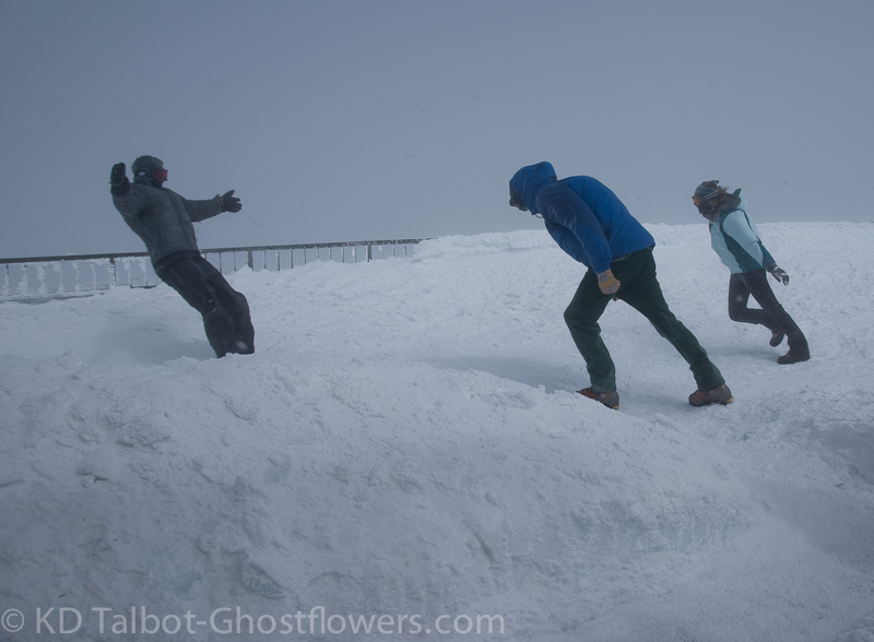
 In the Fall of 2005, I got the opportunity to hike up the mountain with some friends. It was a great challenge, so much so that about half way up I really starting ruing my decision to neither ride up on the Cog Railway, nor the steep, winding road for automobiles. Nevertheless, we made it to the peak and it was a truly awesome experience. A beautiful Fall day turned to winter near the top with temperatures 30 degrees cooler and winds substantially breezier, but the views could not be beaten.